Stadt Matlapa (San Luís Potosí)
Informations
Zahlen
- Landesvorwahl :
- MX
- Postleitzahl :
- 79970
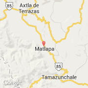
- Breite :
- 21.33809
- Länge :
- -98.83062
- Zeitzone :
- America/Mexico_City
- Zeitzonenbezeichner :
- UTC-6
- Sommerzeit :
- Y
Die stadt Matlapa gehört zu der zustand San Luís Potosí und zu der kommune Matlapa.
Die stadt zählt Matlapa erstreckt sich über 110,28 km² und zälht 29.548 Einwohner (Volkszählung von 2005) für eine Dichte von 267,94 Einwohner pro km². Die maximale Höhe ist 120 m.
Die Bürgermeister ist Cesar Torres Mendioza.
Der englische Name der stadt ist Matlapa.
©photo-libre.fr