Stadt Tzintzuntzan (Michoacán de Ocampo)
Informations
Zahlen
- Landesvorwahl :
- MX
- Postleitzahl :
- 58440
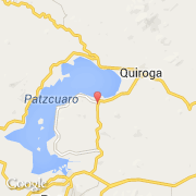
- Breite :
- 19.62672
- Länge :
- -101.57699
- Zeitzone :
- America/Mexico_City
- Zeitzonenbezeichner :
- UTC-6
- Sommerzeit :
- Y
Die stadt Tzintzuntzan gehört zu der zustand Michoacán de Ocampo und zu der kommune Tzintzuntzan.
©photo-libre.fr