Stadt Kotor (Kotor)
Informations
Zahlen
- Landesvorwahl :
- ME
- Breite :
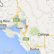
- 42.42583
- Länge :
- 18.77194
- Zeitzone :
- Europe/Podgorica
- Zeitzonenbezeichner :
- UTC+1
- Sommerzeit :
- Y
Die stadt Kotor gehört zu der gemeinde Kotor.
Die stadt zählt Kotor erstreckt sich über 335 km² und zälht 19.000 Einwohner (Volkszählung von 2003) für eine Dichte von 56,72 Einwohner pro km². Die maximale Höhe ist 635 m, die durchschnittliche Höhe beträgt 635 m.
Die Bürgermeister der stadt Kotor ist Marija Ćatović (Democratic Party of Socialists of Montenegro).
Die Amtssprache der stadt ist Idioma montenegrino. Der französische Name der stadt ist Kotor, der englische Name der stadt ist Kotor.
Die Website von Kotor http://www.opstinakotor.com
©photo-libre.fr